13 Beginner Hikes in the Canadian Rockies
I’ve compiled a list of my favorite beginner hikes in the Canadian Rockies. Whether you’re just starting out, or have been hiking for years, these easier, yet rewarding hikes are always great for everyone
Beginner Hikes in Banff National Park
PANTHER FALLS
Distance: 1.3km Round Trip
Elevation: 75m
Time: 1hr
Along the Icefield Parkway, there is a short little trail not far off the road to these beautiful falls. It is a popular ice climbing place in the winter. There is another waterfall in the area, Bridal Veil Falls, but we weren’t quite sure how to find them and being on the Parkway with no service and forgetting my hiking book at home, I decided to leave it for another time when I had a better idea of where to go so prevent getting lost! If you visit in the winter, you will have views of a magical waterfall coming over a cliff. Be aware for climbers and falling ice.

PARKER RIDGE
Distance: 5.1km Round Trip
Elevation: 269m
Time: 2hr
This is a hike I will 100% be doing again, partially because when I attempted this one it was a winter wonderland and we couldn’t even see the views of the Athabasca Glacier. Besides that fact though, it was still a gorgeous hike with the limited views we were provided. It was a short hike, taking us only about 45 minutes to get to the top. So short that people utilize this spot often in the winter for hiking up and skiing down! I can’t wait to do that next year. After only a couple switchbacks, you * should * be greeted with beautiful meadows and glacier views. Parker Ridge is only a few minutes north of Panther Falls, so you can hit two birds with one stone!
BOURGEAU LAKE
Distance: 13.8km Round Trip
Elevation: 960m
Time: 6hr
This one is a bit longer, but because of the distance, the elevation makes it not seem as difficult. Bourgeau Lake is the first of three objectives on this trail — the other two being Harvey Pass and Mt Bourgeau Summit. When I completed this hike, we went all the way to the summit, making it an approx. 27km round trip. It is a steady climb through a beautiful, lush forest. You cross mountain stream to Bourgeau Lake which is enclosed in a glacially carved amphitheater. From the lake, a 2.2 km more difficult trail continues upward to Harvey Pass where you get beautiful views of the peaks along the Continental Divide including Mt Assiniboine and views of Sunshine Meadows and ski area.
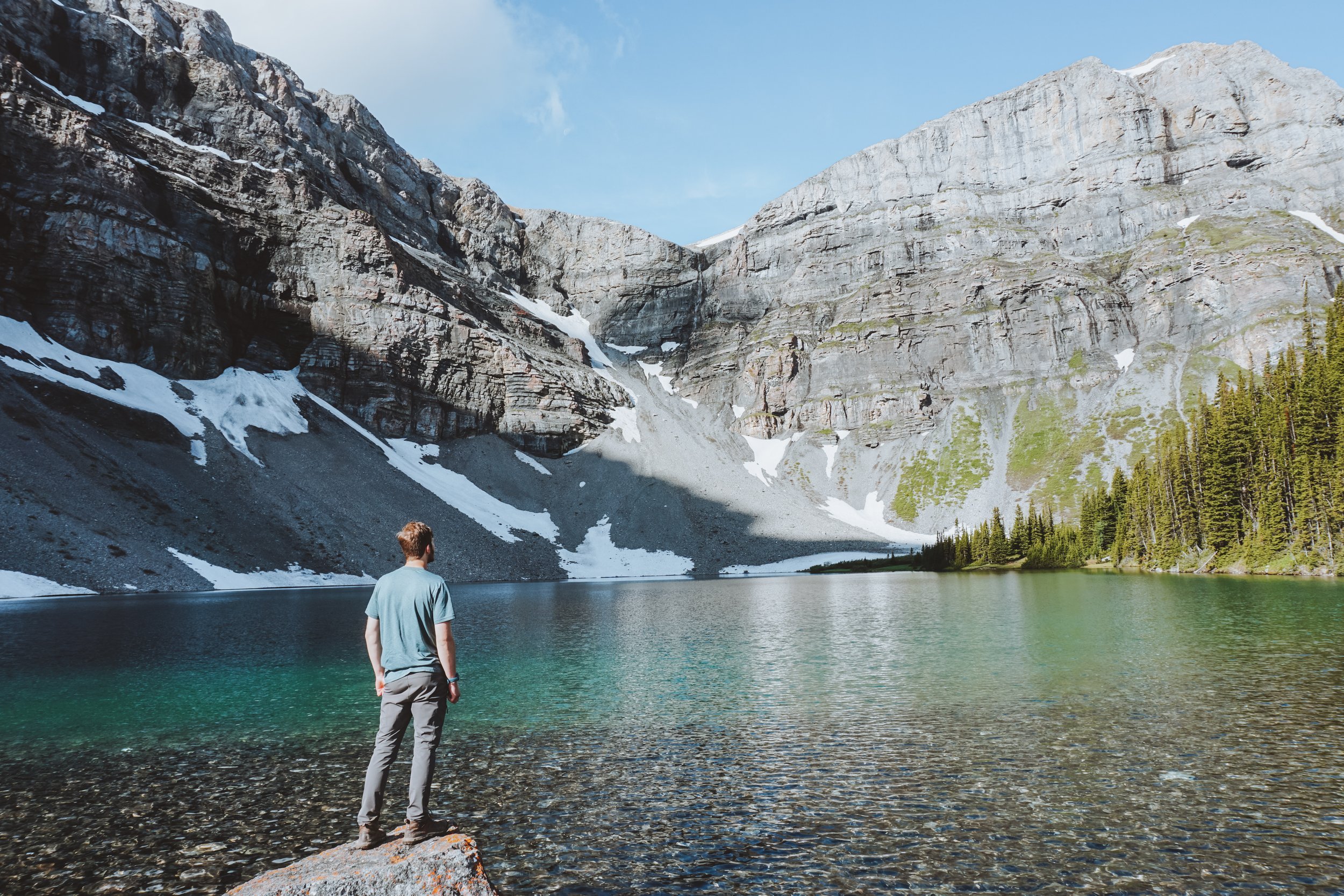
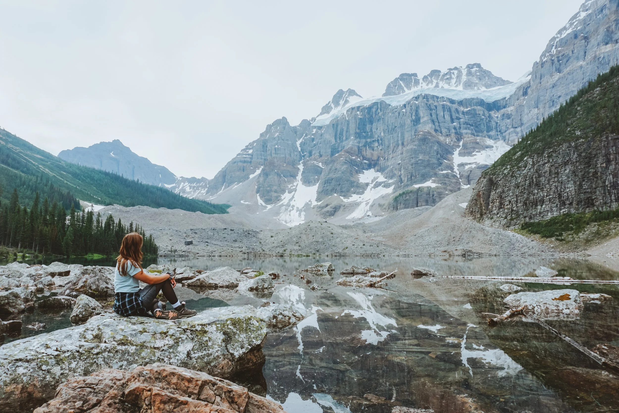
CONSOLATION LAKES
Distance: 7.6km Round Trip
Elevation: 329m
Time: 2-3hr
This hike starts from the Moraine Lake parking lot, which means you must arrive early. The Moraine Lake road doesn’t normally open until May, and closes in October — making it a much more popular area since it can only be seen for a few months out of the year. We arrived to Moraine Lake just after 5am and was able to score one of the last available parking stalls. The trailhead is just off to the left near the bathrooms. You will pass the rockpile and Tower of Babel. After walking through a dense forest alongside a stream, you’ll be greeted with high alpine meadow views, enormous talus slopes and the Quadra Glacier. We decided to take an adventure across the rocks to the back of the lake, only to be greeted by the second lake with magical views of the glacier — all to ourselves! If you choose to do so, make sure your shoes have adequate ankle support for when walking over the large, uneven rocks.
LOWER BANKHEAD INTERPRETIVE TRAIL
Distance: 1.1km Loop
Elevation: 35m
Time: 1hr
If you want a little piece of history, this trail is definitely for you. Just outside the town of Banff towards Lake Minnewanka, you’ll find this interpretative trail that takes you back in time to learn about the history of the mining town of Bankhead — a historical ghost town in the heart of the Canadian Rockies. When the Bankhead Banff coal mine ceased operations in 1922, many of the buildings were moved or dismantled. What remains on the former site of Bankhead, Alberta is now the Bankhead ghost town. You are able to explore the remaining old buildings, locomotives and historic sites that once stood there. I won’t ruin all the fun and share more about the history with you — I’ll leave that for you to find out on this short, fun & easy family-friendly hike!
Beginner Hikes in Jasper National Park
MALIGNE CANYON
Distance: 4.3km Round Trip
Elevation: 142m
Time: 2-3hr
Maligne Canyon is a hike that can be done in both winter and summer, and you will get totally different experiences. In the Summer, you will explore the canyon from above, walking across numerous bridges through a lush, green forest. It does get quite busy in the Summer so I suggest arriving earlier in the day, or in the evening. In the winter, you have the opportunity to walk IN the canyon — an experience like none-other. Starting your hike at Bridge 1/Maligne Canyon Kitchen offers the best views of the canyon as you make your way down to the canyon entrance. Helmets are always suggested, and required if you go with a tour group. Sundog Tours offers guided tours through the canyon — I had the opportunity to do this with Alberta Adventure Girls in the winter of 2020 and I was such a great experience and I recommend to anyone wanting to try!

EDITH CAVELL MEADOWS
Distance: 6-7km Round Trip
Elevation Gain/Loss: 500m
Time: 3-5hr
Mount Edith Cavell is labeled as one of the most prominent peaks in all of Alberta, with one of the most well-known glaciers — Angel Glacier, which I’m sure you can figure out why it got its name! This is a moderate trail, with a steady incline that some may find difficult, but it will be so worth it. The trail offers fragrant subalpine forest, new growth where a glacier recently retreated from the valley, and flowery alpine meadows. You will see classic examples of upper-subalpine forest, treeline vegetation and the alpine region beyond. Along the way there are spectacular views of Angel Glacier, but make sure you stay on the trail to not damage the fragile tundra. Follow the Path of the Glacier Trail to the end of the paved portion, turning hard left soon after onto the route to the meadows. Where the trail follows the edge of the bouldery moraine, watch for little gray pikas and chipmunk-like golden-mantled ground squirrels among the rocks. The trail levels out at treeline, angles left and loops back down to rejoin itself at the edge of the forest.

OVERLANDER TRAIL
Distance: 15.8km One Way
Elevation Gain/Loss: 443m
Time: Your choice!
This trail itself is very long, to allow for biking, but you can hike for however short or however long you’d like! You can start this at the 6th bridge at Maligne Canyon, or at the entrance along the highway just east of the bridge crossing over the Athabasca River. Overlander Trail is one of the park’s signature trails, this route passes by an early valley homestead and through prime montane habitat.
Beginner Hikes in Yoho National Park
HOODOO CREEK
Distance: 5.5km Round Trip
Elevation: 361m
Time: 2hr
If you haven’t heard of this trail before, you would never even know it’s there. This hike starts on a dirt road through an old abandoned campground. In 2013, Parks Canada elected to close Chancellor Peak Campground, which provided 59 campsites on the Western side of Yoho National Park. The decision was made after extreme flooding of the Kicking Horse River ripped through the Chancellor Peak Campground in Summer 2012. A short flat walk of 900m down this road brings you to a new bridge over Hoodoo Creek. Cross over the bridge and start the climb. This trail is quite steep, but not very long. It gains over 300m of elevation over less than a couple of kilometers. The switchbacks continue until you round the corner with a clear view of Mt. Chancellor and Wapta Falls in the distance. More on that in a later post. Continue around the bend and you will begin to see views of several Hoodoos jutting out of the side of the hill and Hoodoo Creek directly below. You will reach a sign for a couple of different viewpoints. I advise taking the upper view point as the lower simply wasn’t very impressive. After about 1.5km from the new bridge (mentioned above), you will come to a junction point. The left path continues up for another 325m (5min) to the upper viewpoint of the hoodoos. Alternatively, from the junction point the right path winds down for 200m (2min) to the creek at the base of the Hoodoo formations.
WAPTA FALLS
Distance: 2.6km Round Trip
Elevation: 30m
Time: 1.5hr
This hike is much more popular than Hoodoo Creek, and gives you views of one of the widest waterfalls in Canada, as well as the largest waterfall on the Kicking Horse River. Just within the Yoho National Park west boarders, you’ll find the turnoff for Wapta Falls. After driving 2kms down the road you’ll come to the parking lot and this is where you’ll begin your easy journey! You’ll walk through a lush forest for about 2.3 kms until you read the lookout of Wapta Falls. Once you get to take in the views at the lookout, there is a short side trail that allows you to go down to the base of the waterfall for a better vantage point. Be careful to not get too close or you’ll get soaked from the mist!

TROLL FALLS - KANANASKIS
Distance: 3.5km Round Trip
Elevation: 60m
Time: 1hr
This is a hike that is especially good for families or those hiking with younger children! Rumor has it is that there is troll dolls hidden along the trail for people to find — but who is to say they are still there! This is a short, easy hike that takes you past a beautiful meadow, and has tipis built out of trees for you to explore. There is an upper and lower falls, but the upper is closed time to time due to safety of flooding and ice! If you head out in the winter, I suggest bringing microspikes.
PRAIRIE VIEW - KANANASKIS
Distance: 12.8km Round Trip
Elevation: 421m
Time: 4-5hrs
The first time I did this hike was in May of 2021 and I enjoyed it so much that I had to do a sunrise attempt as well — a good one if you’re looking for a sunrise hike! Do not get this one mixed up with the difficult scramble ‘Prairie Lookout’! The Prairie View Trail, often called the Barrier Fire Lookout trail, switchbacks uphill on an old forestry road to a spectacular viewpoint looking south over Barrier Lake. From the viewpoint, you can either continue to the north side of the ridge to the Barrier Fire Lookout and a view over the Bow Valley, or descend towards Jewell Pass on a trail that is a little less obvious from the top, but becomes more clear as you reach the forest. If you are going earlier season, definitely pack microspikes!

SIFFLEUR FALLS - NORDEGG
Distance: 7km Round Trip
Elevation: 80m
Time: 2hr
This was another hike I had the opportunity to complete with Alberta Adventure Girls in the midst of Winter! This is another easy, family-friendly hike that everyone in the family will enjoy. You’ll have views of prominent mountain peaks and wide valleys — and there is even a suspension bridge! The trail heads into the forest for a short section before coming up to great views of the canyon and a series of viewing platforms. The falls ahead are impressive with the Siffluer River plunging 15m through a narrow channel in the rock. Take the time to enjoy the views and make sure to stay a safe distance from the cliffs and canyon edge. Unfortunately the area has seen many casualties over the year.


Thank-you for following along with this week’s blog on 13 Beginner Hikes in the Canadian Rockies. Feel free to leave any comments, feedback or questions below.
Note: My website contains ads placement and affiliate links so I can continue to produce educational and helpful content just like this.